Asked

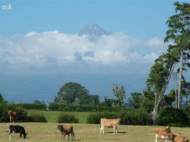
Here is a fantastic free download for all you GA pilots who like a little mountainous scenery: Mount Taranaki aka Mount Egmont volcano from “Godzone” New Zealand.

This file was originally part of a payware package by Robin Corn, but has now been updated covering a much larger area to fit the latest Geographx terrain mesh files and released as freeware!

I don’t even have any special mesh for NZ, but the results are simply stunning. I took an early morning flight from NZNP (New Plymouth) to NZSD (Stratford) circling the large volcanic conical base, going up to the 2518 metre summit, then gliding down around the foothills and lush countryside below.

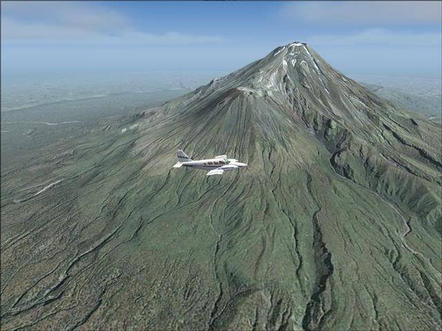
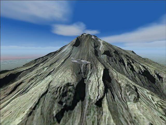
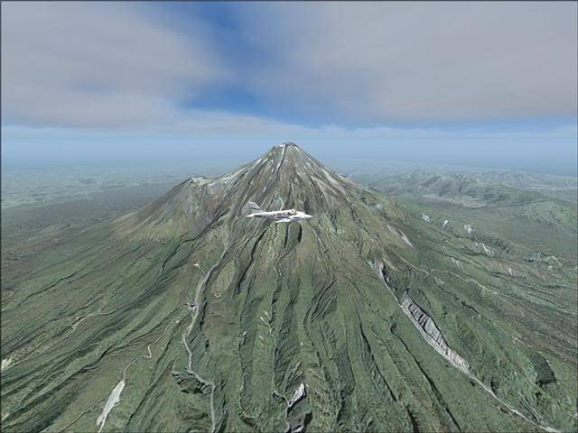
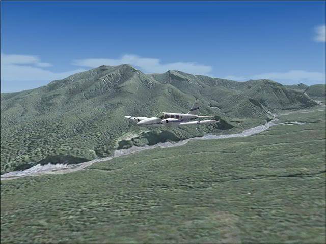
This download is just 41mb that includes “40 x 50 kilometres of fully autogenned daytime summer photo-real textures” and can be found here: http://library.avsim.net/search.php?SearchTerm=Egmont&CatID=root

😂

Answers 11 Answers

Answered

😳 OMG that is beautiful!!!. Down;oading it now. Wall Bashing its taking a while.

Answered

LOL was it worth it then alohajoe?

Answered

Wow great find CT, looks very realistic too. 👍

Answered

Mr Cheekytrolly,

you're becomming a bit of a star with these scenery finds ! This is the 2nd scenery that you've pointed out that is absolutely first class and getting a lot of flying on my system at the moment !

Good on yer' ! Right, let's get off down to NZ for some scenic flying 😎

David.

Answered

hey cheeky, what are your mip map levels on? my nz looks rather pooey Crying or Very sad

Answered

Hinch- my MIP mapping quality is on 4...I dont know what it means though?

And thanks Mr Pro-Sim, what was the other scenery you liked that I reccomended?

Answered

Yes Omg wow its awesome lol THanks s00 muchh

Answered

cheeky great find and great shots....again!! Poke in Eye 😉

Micah 😉

Answered

lol where is the nearest airport located to this mountain i cant find the mountain 😞!

Answered

I took an early morning flight from NZNP (New Plymouth) to NZSD (Stratford)

Nik, please actually read the post before posting questions... the answer is already above 🙄 Rules Doh!

I am actually driving down to this mountain today, it's 5 hours and 360km away from my house! I hope to get some photos of the real thing uploaded of the real thing when I return on Monday, so you guys can compare the two, and see how amazingly realistic this addon is!

Bye for now

Answered

... Well I am back now, and as promised, here is a photo I took from the base of Mount Taranaki (Also known as Mount Egmont)

Unfortunately, the peak is covered in cloud and the closer I got to it, the angle of my line of sight grew more and more acute untill the peak disappeared completely behind clouds.

You can read a full trip report here if your interested: https://forum.flyawaysimulation.com/forum/topic/12311/roadtrip-report/#76486

Still does not answer your question? Ask a new question!

If the question and answers provided above do not answer your specific question - why not ask a new question of your own? Our community and flight simulator experts will provided a dedicated and unique answer to your flight sim question. And, you don't even need to register to post your question!

Ask New Question...