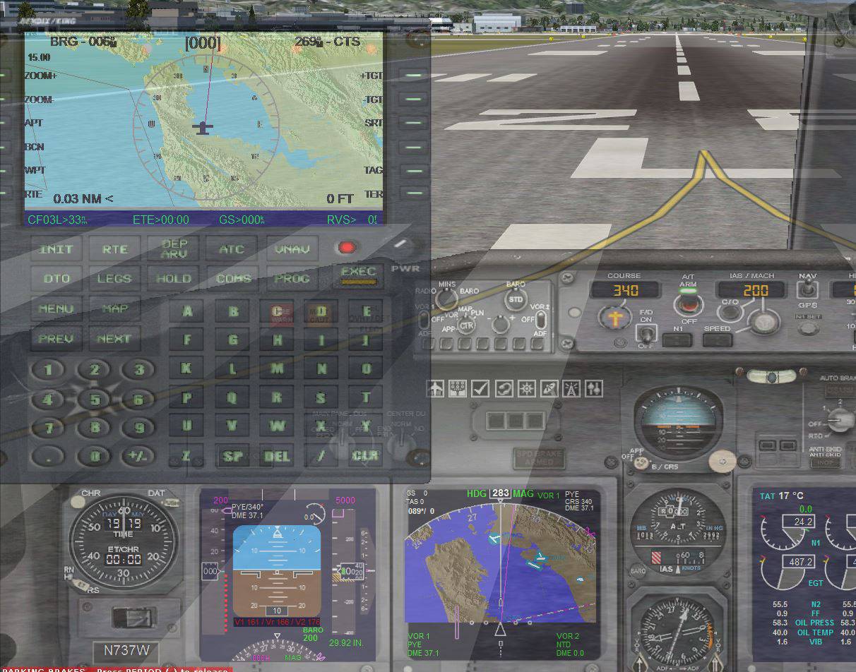
ok I found the mfd.xml it has the lines that setup the map. I would like to know if there is a way to display the same map that my FMC uses for my MFD
here is the map lines for my MFD
--------------------------------------------------------------------------------------
<Element id="Expanded Map">
<FloatPosition>0.000,27.000</FloatPosition>
<Visibility>(L:TFR_RDR_ON/OFF,enum)
</Visibility>
<MaskImage id="mfd_expanded_map_mask.bmp" Name="mfd_expanded_map_mask.bmp">
</MaskImage>
<CustomDraw id="CustomDraw" Name="fs9gps:1:map">
<Size>260,180</Size>
<Bright>False</Bright>
<CustomDrawParam id="CustomDrawParam" Name="BackgroundColor">
<Value>0x341117</Value>
</CustomDrawParam>
<CustomDrawParam id="CustomDrawParam" Name="X">
<Value>@MapWidthExpanded</Value>
</CustomDrawParam>
<CustomDrawParam id="CustomDrawParam" Name="Y">
<Value>@MapHeightExpanded</Value>
</CustomDrawParam>
<CustomDrawParam id="CustomDrawParam" Name="CenterX">
<Value>@MapWidthExpanded 2 /</Value>
</CustomDrawParam>
<CustomDrawParam id="CustomDrawParam" Name="CenterY">
<Value>@MapHeightExpanded</Value>
</CustomDrawParam>
<CustomDrawParam id="CustomDrawParam" Name="Zoom">
<Value>@RangeMiles 2800 *</Value>
</CustomDrawParam>
<CustomDrawParam id="CustomDrawParam" Name="Latitude">
<Value>(A:GPS POSITION LAT, Radians)</Value>
</CustomDrawParam>
<CustomDrawParam id="CustomDrawParam" Name="Longitude">
<Value>(A:GPS POSITION LON, Radians)</Value>
</CustomDrawParam>
<CustomDrawParam id="CustomDrawParam" Name="Heading">
<Value>(A:GPS GROUND TRUE TRACK, Radians)</Value>
</CustomDrawParam>
<CustomDrawParam id="LayerTerrain" Name="LayerTerrain">
<Value>1</Value>
</CustomDrawParam>
<CustomDrawParam id="DetailLayerTerrain" Name="DetailLayerTerrain">
<Value>3</Value>
</CustomDrawParam>
<CustomDrawParam id="DetailLayerVehicles" Name="DetailLayerVehicles">
<Value>3</Value>
</CustomDrawParam>
<CustomDrawParam id="TerrainShadow" Name="TerrainShadow">
<Value>1</Value>
</CustomDrawParam>
<CustomDrawParam id="WaterColor" Name="WaterColor">
<Value>0xcc3333</Value>
</CustomDrawParam>
<CustomDrawParam id="Elevation0Color" Name="Elevation0Color">
<Value>0x467793</Value>
</CustomDrawParam>
<CustomDrawParam id="Elevation1000Color" Name="Elevation1000Color">
<Value>0x425f6e</Value>
</CustomDrawParam>
<CustomDrawParam id="Elevation2000Color" Name="Elevation2000Color">
<Value>0x33555b</Value>
</CustomDrawParam>
<CustomDrawParam id="Elevation3000Color" Name="Elevation3000Color">
<Value>0x33555b</Value>
</CustomDrawParam>
<CustomDrawParam id="Elevation4000Color" Name="Elevation4000Color">
<Value>0x1f423e</Value>
</CustomDrawParam>
<CustomDrawParam id="Elevation5000Color" Name="Elevation5000Color">
<Value>0x1f423e</Value>
</CustomDrawParam>
<CustomDrawParam id="Elevation6000Color" Name="Elevation6000Color">
<Value>0x112e1e</Value>
</CustomDrawParam>
<CustomDrawParam id="Elevation7000Color" Name="Elevation7000Color">
<Value>0x112e1e</Value>
</CustomDrawParam>
<CustomDrawParam id="Elevation8000Color" Name="Elevation8000Color">
<Value>0x11291d</Value>
</CustomDrawParam>
<CustomDrawParam id="Elevation9000Color" Name="Elevation9000Color">
<Value>0x11291d</Value>
</CustomDrawParam>
<CustomDrawParam id="Elevation10000Color" Name="Elevation10000Color">
<Value>0x6e8f9f</Value>
</CustomDrawParam>
<CustomDrawParam id="Elevation11000Color" Name="Elevation11000Color">
<Value>0x6e8f9f</Value>
</CustomDrawParam>
<CustomDrawParam id="Elevation12000Color" Name="Elevation12000Color">
<Value>0xa1b7bd</Value>
</CustomDrawParam>
<CustomDrawParam id="Elevation13000Color" Name="Elevation13000Color">
<Value>0xa1b7bd</Value>
</CustomDrawParam>
<CustomDrawParam id="Elevation14000Color" Name="Elevation14000Color">
<Value>0xd6dde0</Value>
</CustomDrawParam>
<CustomDrawParam id="Elevation15000Color" Name="Elevation15000Color">
<Value>0xd6dde0</Value>
</CustomDrawParam>
<CustomDrawParam id="Elevation16000Color" Name="Elevation16000Color">
<Value>0xb6bbbe</Value>
</CustomDrawParam>
<CustomDrawParam id="Elevation17000Color" Name="Elevation17000Color">
<Value>0xb6bbbe</Value>
</CustomDrawParam>
<CustomDrawParam id="CustomDrawParam" Name="LayerIntersections">
<Value>0 (L:MapItem Shown, number) ==</Value>
</CustomDrawParam>
<CustomDrawParam id="CustomDrawParam" Name="LayerAirports">
<Value>1 (L:MapItem Shown, number) ==</Value>
</CustomDrawParam>
<CustomDrawParam id="CustomDrawParam" Name="LayerNDBs">
<Value>2 (L:MapItem Shown, number) ==</Value>
</CustomDrawParam>
<CustomDrawParam id="CustomDrawParam" Name="LayerVORs">
<Value>3 (L:MapItem Shown, number) ==</Value>
</CustomDrawParam>
<CustomDrawParam id="CustomDrawParam" Name="LayerFlightPlan">
<Value>1</Value>
</CustomDrawParam>
<CustomDrawParam id="ObjectDetailLayerAirports" Name="ObjectDetailLayerAirports">
<Value>0x4F</Value>
</CustomDrawParam>
</CustomDraw>
</Element>
--------------------------------------------------------------------------------------
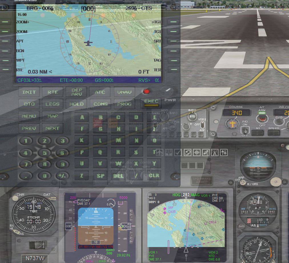
Here is the map lines for my FMC
--------------------------------------------------------------------------------------
</Element>
;/////////////////////////////////////////////////////////////////////////////////////////////////////////////////////////
<Element Name="GPS Map">
<Visible>(L:fmcBendixGA_group, number) @GPSMapPageGroup == </Visible>
<Element name="Map">
<Position X="32" Y="16" />
<Visible>(L:fmc_LayerFollow) 0 ==</Visible>
<CustomDraw Name="fs9gps:1:map" TrackUp="Yes" X="258" Y="213" LayerTerrain="Yes" LayerAirways="Yes" LayerBorders="Yes" LayerFlightPlan="Yes"
FlightPlanLineWidth="1.5" ActiveColorLayerFlightPlan="0x7010B0" PastColorLayerFlightPlan="0xF0F0F0"
ColorLayerFlightPlan="0xF0F0F0" Bright="Yes" CenterX="129" CenterY="108">
<UpdateAlways>1</UpdateAlways>
<CenterY>108</CenterY>
<CenterX>129</CenterX>
<Zoom>(L:fmc_ZoomFactor, number) 1852.0 *</Zoom>
<Latitude>(A:GPS POSITION LAT, Radians)</Latitude>
<Longitude>(A:GPS POSITION LON, Radians)</Longitude>
<Heading>(A:GPS GROUND TRUE TRACK, Radians)</Heading>
<TrackUp>1</TrackUp>
<TerrainShadow>True</TerrainShadow>
;//////////////////////////////////////////////////////////////////
<LayerFlightPlan>1</LayerFlightPlan>
<LayerVehicles>1</LayerVehicles>
<LayerAirports>(L:fmc_LayerAirports) 0 &</LayerAirports>
<LayerVORs>(L:fmc_LayerVORs) 0 &</LayerVORs>
<LayerILSs>(L:fmc_LayerAirports) 0 &</LayerILSs>
<LayerNDBs>(L:fmc_LayerVORs) 0 &</LayerNDBs>
<LayerIntersections>(L:fmc_LayerIntersections) 1 ==</LayerIntersections>
<LayerAirspaces>(L:fmc_LayerAirports) 0 &</LayerAirspaces>
<LayerAirways>(L:fmc_LayerAirWays) 0 &</LayerAirways>
<LayerTerrain>(L:fmc_LayerTerrain) 0 &</LayerTerrain>
<LayerApproach>1</LayerApproach>
;//////////////////////////////////////////////////////////////////
<DetailLayerVehicles>1</DetailLayerVehicles>
<DetailLayerBorders>1</DetailLayerBorders>
<DetailLayerAirports>1 1 3 3 3 3 4 4 4 4 4 5 5 5 5 5 5 5 5 5 5 5 5 5 24 (L:fmc_ZoomStep, number) case</DetailLayerAirports>
<DetailLayerVORs>0x2</DetailLayerVORs>
<DetailLayerIntersections>1 1 1 1 1 1 1 2 2 2 2 2 2 2 2 2 2 2 2 2 2 2 2 2 24 (L:fmc_ZoomStep, number) case</DetailLayerIntersections>
<DetailLayerAirspaces>-1</DetailLayerAirspaces>
<DetailLayerApproach>-1</DetailLayerApproach>
;/////////////////////////////////////////////////////////////////
<ObjectDetailLayerAirports>0x43 0x23 0x13 0xA 0x9 0x6 0x5 0x7F 8 (L:fmc_APdetail, number) case</ObjectDetailLayerAirports>
<ObjectDetailLayerVORs>0x3</ObjectDetailLayerVORs>
;//////////////////////////////////////////////////////////////////
<ColorLayerAirportsTowered>0xA0A0A0</ColorLayerAirportsTowered>
<ColorLayerAirportsUntowered>0x808080</ColorLayerAirportsUntowered>
<ColorLayerAirspaces>0xd5d5ff</ColorLayerAirspaces>
<ColorLayerILSs>0x00ff00</ColorLayerILSs>
<ColorLayerAirwaysVictor>0xc4c400</ColorLayerAirwaysVictor>
<ColorLayerVehicles>(L:fmc_LayerTerrain) if{ 0x006666 } els{ 0x00ffff }</ColorLayerVehicles>
;//////////////////////////////////////////////////////////////////
<TextColorLayerVehicles>(L:fmc_LayerTerrain) if{ 0x503030 } els{ 0xff80ff }</TextColorLayerVehicles>
<TextDetailLayerAirports>1 1 1 1 1 1 1 1 1 1 1 1 1 4 4 4 4 4 4 4 4 4 4 4 24 (L:fmc_ZoomStep, number) case</TextDetailLayerAirports>
<TextDetailLayerVORs>2</TextDetailLayerVORs>
<TextDetailLayerNDBs>2</TextDetailLayerNDBs>
<TextDetailLayerIntersections>1</TextDetailLayerIntersections>
<TextDetailLayerVehicles>2 2 2 2 2 2 2 2 2 2 2 2 2 2 2 2 2 2 2 2 2 2 2 2 24 (L:fmc_ZoomStep, number) case (L:fmc_LayerTags) min</TextDetailLayerVehicles>
;///////////////////////////////////////////////////////////////////
<PanHorizontal>(L😛anHorizontal)</PanHorizontal>
<PanVertical>(L😛anVertical)</PanVertical>
<PanReset>(L😛anReset)</PanReset>
<LayerFlightPlan>1</LayerFlightPlan>
<LayerApproach>(@g:currentPageWPT) 3 ==</LayerApproach>
<LayerApproachAirport>(@c:WaypointAirportICAO)</LayerApproachAirport>
<LayerApproachApproach>(@c:WaypointAirportCurrentApproach)</LayerApproachApproach>
<LayerApproachTransition>(@c:WaypointAirportApproachCurrentTransition)</LayerApproachTransition>
</CustomDraw>
</Element>
--------------------------------------------------------------------------------------I can see that the coding is not the same
the mfd.xml resides in my b737_800.cab in my panel folder
the fmc.xml resides in my Alrot_CitX.cab in my panel folder

 3 Answers
 Jump to latest