abmukh80 wrote:
Hi Faust,
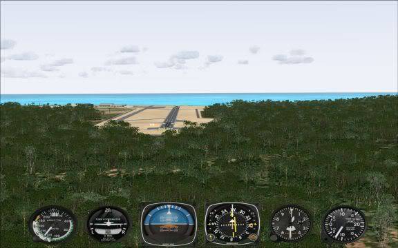
If you could throw some light on this as well..... how do i come to know if the airport has a glidescope or i've to manually descend? Some people have posted replies here saying not all airports have glidescope but can have ILS approach!
Help me on that please!!
Any airport that has "ILS" will have a localizer and glideslope. If they only have a localizer it would be called a LOC or localizer approach. In real life you would have instrument approach plates that shows you each approach with all the information such as how far you can descend on a localizer only approach also known as MDA (minimum descent altitude) I actually have purchased approach plates for a few states to use with the sim. Without plates you are just really guessing on how to properly fly the approach. Usually ILS's are pretty similar which is why many people fly them in the sim but there are VOR, NDB, GPS and other types of approaches. Airnav.com is a decent place to find general info about what each airport offers. If you want to purchase approach plates, NOS plates are the cheapest, then there are Jeppesen, the ones I prefer which are more expensive. mypilotstore.com sells both types.
For an online solution I would recommend Jeppesen's Simchart. It's $41 or so but you get access to every approach plate with the ability to display it in FSX or print it out (probably the better option) There's no subscription so it should work "forever." I use it myself actually.
Also I know within the sim if you click into the map then click on your airport it will list the ILS approaches and their freq's but that's mostly it. Like I said if it lists an ILS freq. then there will be a localizer and glideslope.
So these are just some information sources that *I* know about that might help the simmer. I'm sure it's not a complete inventory. There may some addons that give you some good additional info or other sources as well. I have heard good things about aerosoft's "Flight Commander" but I am uncertain to what that exactly gives you. Good luck. Instrument stuff is the most fun, for me.
One last thing I thought of. If you get into the GPS and figure out how to use it well, it has a lot of airport info like approaches and freqs also. If you fly a GPS approach, again you would really need the approach plate to know how far you can descend. GPS approaches do not give vertical guidance.
Edit: I was looking over airnav.com and it looks like they give you access to NOS approach plates. I'd say that's a great free way to do it but they only supply U.S. plates.
Last edited by faust1200 on Wed Dec 26, 2007 12:51 pm, edited 4 times in total

 First Officer
 7 Answers
 Jump to latest

 Trainee