Flight Routing - LHR to MIA


Hi peeps,
I am flying out to miami on 12th Jan with AA on a 777.
I was just wondering what routing we might take on the way? Whether as it is a twin engined jet, we will follow the coast upto greenland and back down over canada or just go straight over the pond.
Any ideas?
Ta
Leachus
 5 Answers
 Jump to latest
you'll probably sweep under, but you're definantly not going all the way up to canada. it's pretty much a straight shot. you might get a look at the east coast of the US, but the flights pretty boring 😂

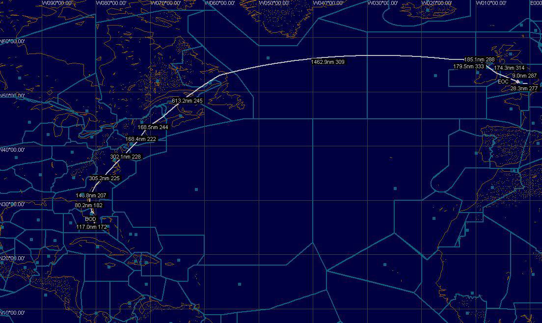
this is what routefinder comes up with - which is said to be "fairly" accurate.
oh wow, thats quite cool.
Where did you find that?
Thanks
Leachus
The screenshot is from FS Navigator, a payware add-on (has a 20 flight free trial I believe)
You need this or an aircraft with decent FMC to be able to properly fly online as default FS9 Navigation methods really do not serve the purpose well enough (unless you have got an extreme amount of spare time).
The route is generated by RouteFinder (http://rfinder.asalink.net/free/)
The complete route shown above is
EGLL SID CPT UL9 KENET UN14 MEDOG UL18 DUB UM17 PIKIL NATE STEAM N220B TOPPS J581 ENE J55 HTO VS1 ORF J121 CHS J174 MILIE J79 BEENO J103 OMN STAR KMIA
I've not yet flown into the US myself (I hope to take my first holiday there within the next two-four months - looking forward to it!) but I know for a fact that Continental's flight from KIAH to EHAM does (almost?) route over Canada. It may seem a strange route on charts, but i am told that this is shorter/quicker than a straight line drawn on a flat map from KIAH to EHAM.

This site is worth a look too:
You can see the shortest distance between any two airports, using FAA, IATA or ICAO codes. You can also input a location, specify the max range of your aircraft, and see where you could go. It will even take account of ETOPS rules, if you ask it to.
Not a precise guide, since planes don't always fly the shortest path (for political reasons, weather patterns and so on) but it's an interesting site.
Still does not answer your question? Ask a new question!
If the question and answers provided above do not answer your specific question - why not ask a new question of your own? Our community and flight simulator experts will provided a dedicated and unique answer to your flight sim question. And, you don't even need to register to post your question!
Search our questions and answers...
Be sure to search for your question from existing posted questions before asking a new question as your question may already exist from another user. If you're sure your question is unique and hasn't been asked before, consider asking a new question.
Related Questions
Flight Sim Questions that are closely related to this...

